What we can do for you...
What we can do for you...
Example problem—where to place a new campground near Bandelier National Monument? Criteria to consider include the following:
Topography—choose flat or gently sloping terrain; avoid flood-prone, low-lying areas
Soil type and drainage—choose well-drained soil to avoid mud; avoid sandy or soft soils for stability
Vegetation and shade—choose areas with trees for shade; preserve natural vegetation for aesthetics and erosion control
Water sources—choose proximity to clean water source; maintain proper distance from rivers and lakes for sanitation
Wildlife considerations—avoid known wildlife corridors or endangered species areas; provide bear-proof waste disposal sites and equipment
Accessibility—choose good access to roads and emergency access
Utilities—choose an area near medical facilities, fuel stations, grocery stores
Zoning—ensure area is zoned for campground use
Natural hazards—avoid wildfire-prone areas and unstable slopes
Security—consider visibility and oversight to reduce risk
Environmental impact—plan for waste disposal, erosion control, and minimal wildlife disruption
RAW DATA
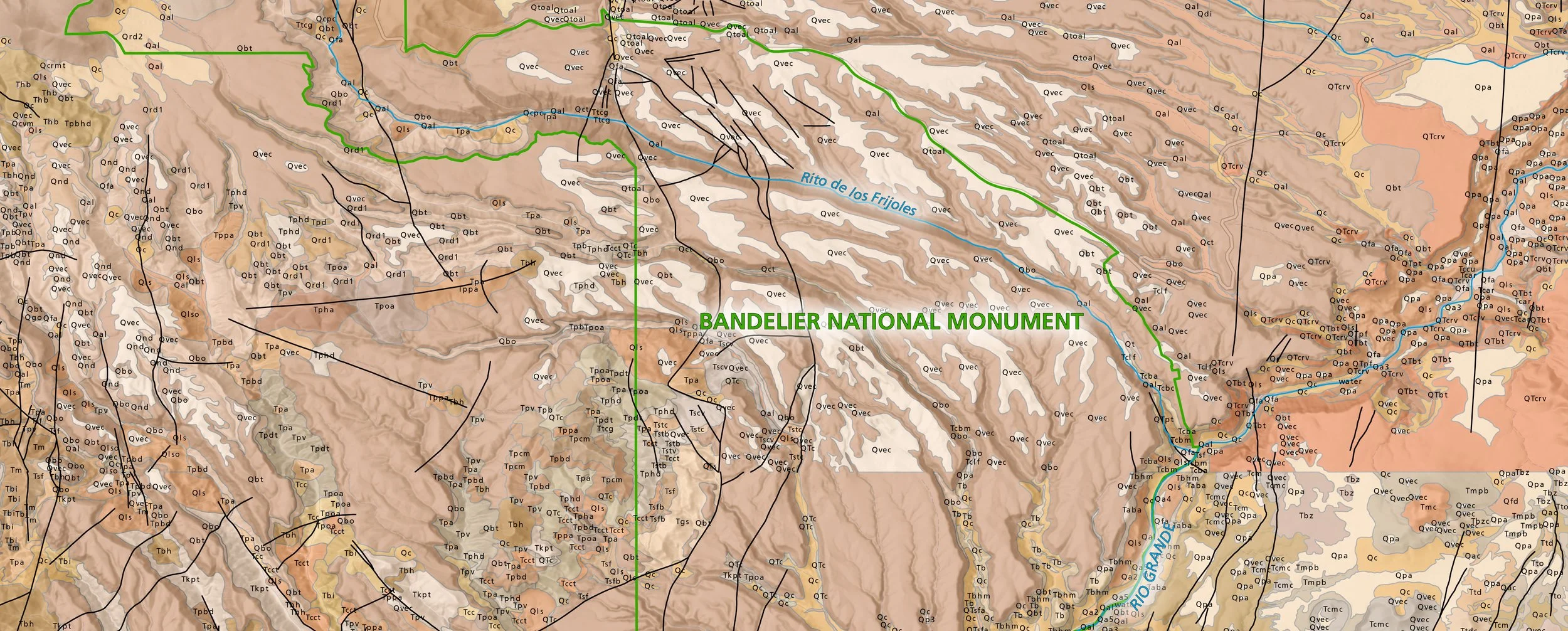
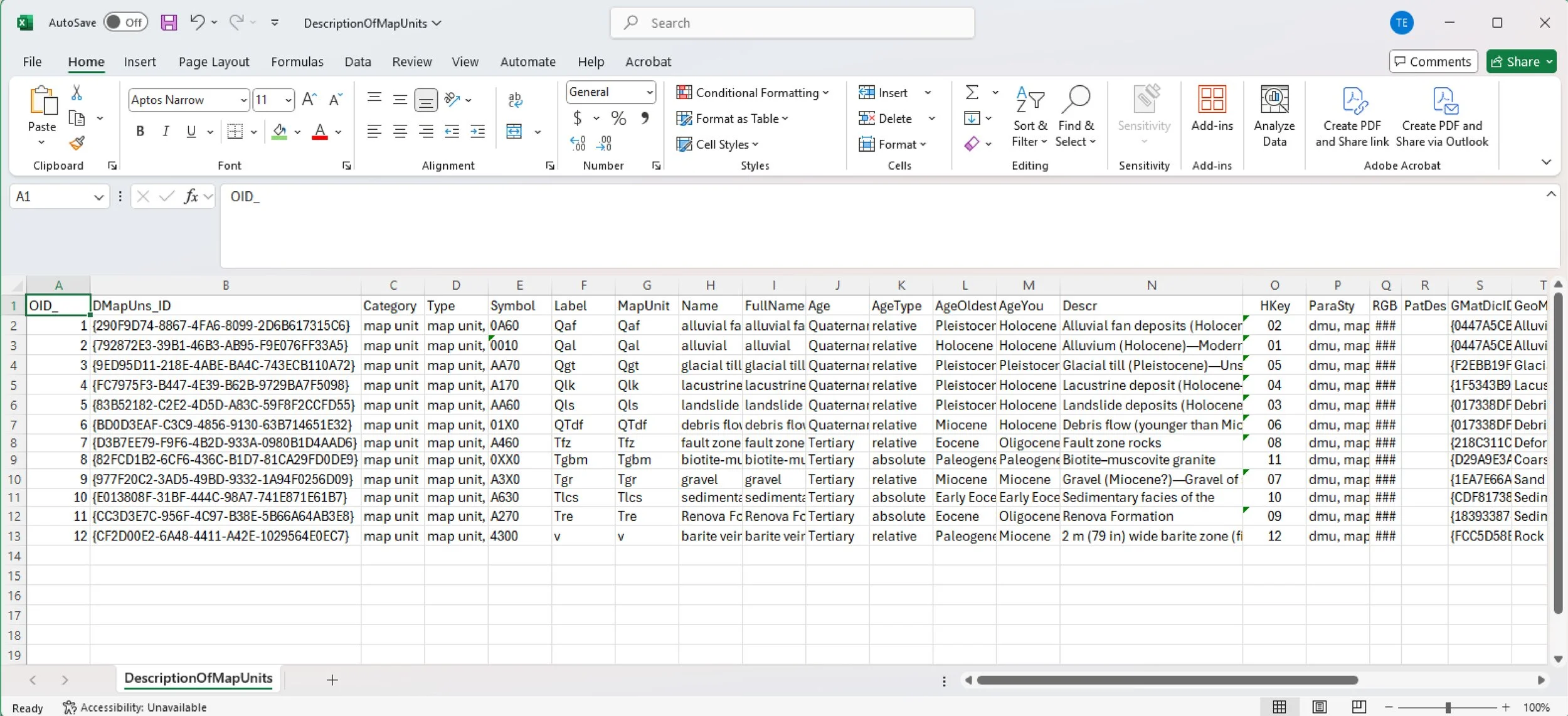
We start with something that might look like this…confusing tables of numbers, coordinates, descriptions, and other geospatial information.

We design custom tools in ArcGIS Pro, or use in-house tools, to bring the data into a geographic information system (GIS). Now the data are clear, legible, oriented in space, and ready for overlay and analysis.
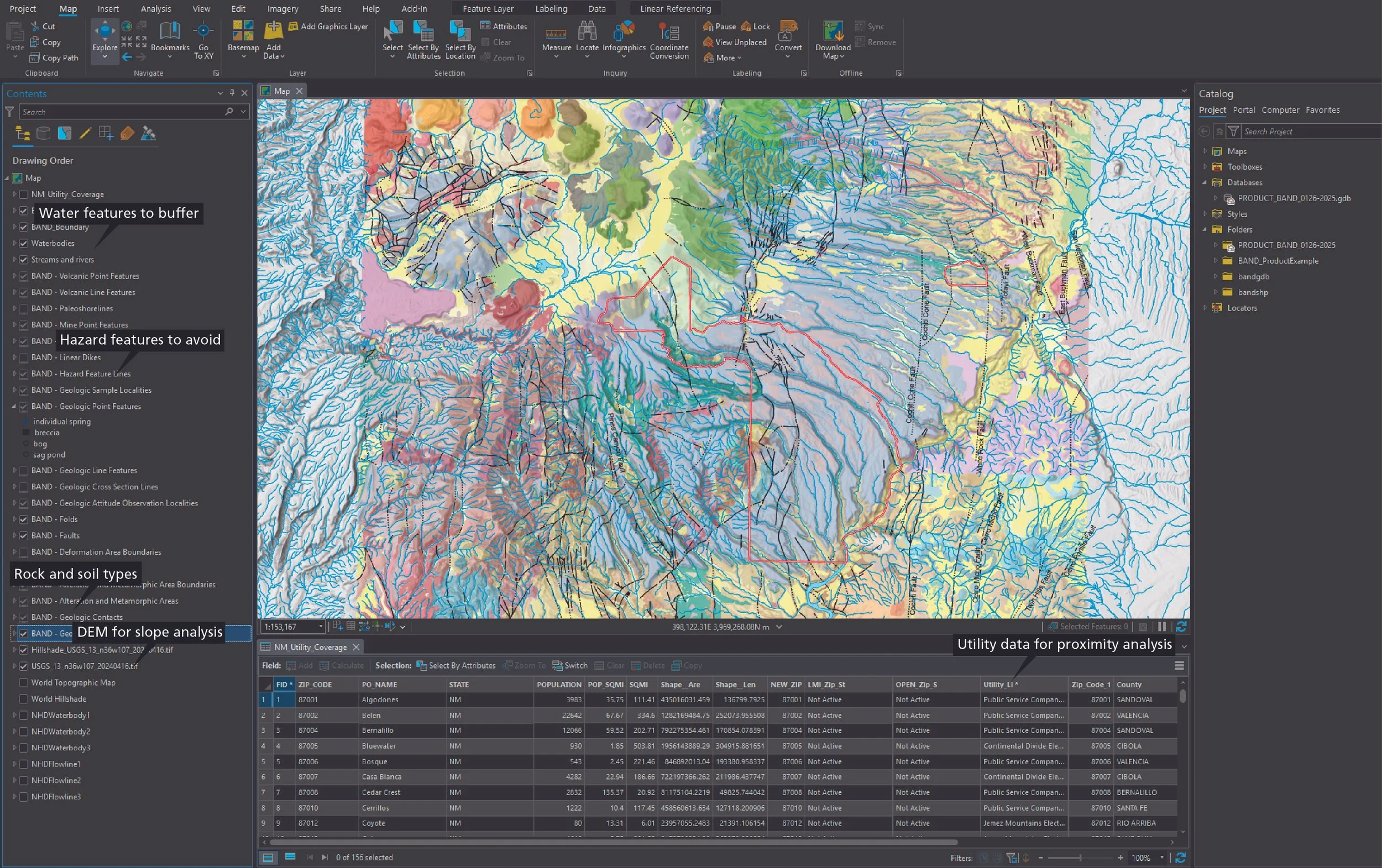
The GIS is ready to go!
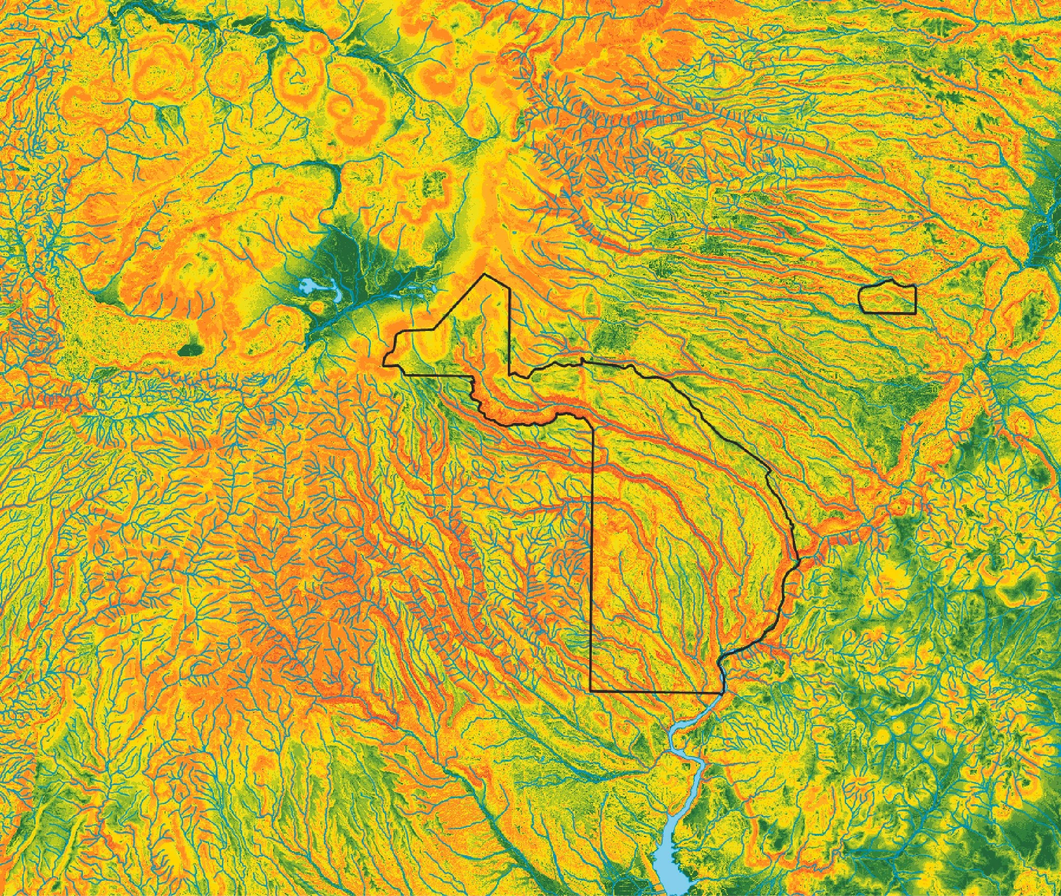
A slope analysis shows areas to avoid due to steep slopes prone to landslides and rockfalls…

After all the analyses, buffers, zones, and considerations, the GIS reveals the answer and generates ideal campground sites. The user can act on the possibilities with confidence, knowing no stone was left unturned in the determination.
Now our wordsmith, working with attractive and relatable graphics, takes the results of all the analyses and distills them into a coherent, clear, and comprehensive document outlining all the information, criteria, and results.


Our team has collaborated on more than a dozen products for the National Park Service. To date, most of our efforts have culminated in baseline geologic reports that provide valuable information for park stewardship. Each report is park specific and serves as a one-of-a-kind document that synthesizes geologic heritage, geologic hazards, and geologic resource management needs. Each report is based on park-specific GIS data, which are compiled from many source maps. In most cases, these data are the first instance in which a complete geologic picture of a park is revealed. In addition to compiled maps, our team’s in-depth research utilizes peer-reviewed publications, unpublished proprietary documents, field investigations, and discussions with park staff or academic institutions. Collectively, these approaches guide our technical writing and are enhanced by visually appealing graphics that illustrate complex concepts.
Not only are the skills behind these products relevant for natural resource management, they are applicable to diverse sectors such as urban planning, commercial development, environmental conservation, natural resource protection, disaster management or mitgation, public education, and public safety.